Hiking Mount Kumotori, Japan (in the Rain and Mud)

Entry posted by MattS in Trips ·
5,337 views
The trail before me had become a treacherous, muddy mess. My backpack felt like a sodden weight pulling me down, and my shoes squished and oozed water with every step. I was looking down at what would have been a sharp descent, now transformed into a muddy slide. As I debated between simply sitting down on the trail and letting gravity carry me along or staggering forward and attempting to remain upright, I thought again about how I had let this happen.

The answer involved a series of bad decisions and bravado that all began with a hat. It had been the parting gift of a friend of mine when I left my home in Connecticut to teach English in Japan, and was of a rugged, outdoorsy quality, tan in color, with a mid-size brim. Its involvement in my current predicament began with a humble interaction at Japan’s Narita airport. At the time, I was absorbed in the process of following a series of guides to the hotel bus when another soon-to-be-teacher spoke up from behind me. I didn’t quite catch what he said, though, because I was in that unique state of exhaustion only a sleepless 14-hour plane trip can bring on. I asked him to repeat himself, and he obliged.
“I said I like your hat.”
“Thanks,” I replied, “I got it from a friend.”
“Oh?” he said, “Are you into hiking, then?”
“Yes,” I answered, though I hadn’t been anywhere near a hiking trail in the last eight years. I suppose I was trying to live up to my hat’s outdoorsy image. I then followed up this half-truth with an ambiguous statement. “I used to go on hikes all the time with my family.”
“That’s great!” was his trusting response. “You must be excited to get out and do some hiking now that you’re here. There are mountains all over the place.”
“Yeah,” I said, caught up in the spirit of the conversation, “I’m going to look up some good local trails after I get settled in.”
Then the bus showed up, silencing us both, and everything dissolved once more into a whirlwind of activity. But that conversation stuck with me. I really had enjoyed hiking when I was younger, and Japan seemed like the perfect place to get back into it. There was an abundance of trails, it would give me something fun to do with my free time, and actually going on some hikes would help me feel less like a liar.
The idea took hold. When I introduced myself to schoolchildren in the city of Hachinohe, where I taught, the three hobbies I always brought up were reading, listening to music, and hiking. When I and my fellow teachers were at welcome parties, I would ask my new coworkers if they knew any good hiking trails, or had any interest in the activity. Their answers to the first question tended to be vague, and I never did find someone who answered affirmatively to the latter. Still, I got the idea there were lots of places nearby where I could go out and practice my newly christened hobby.
And yet it was months before I ever acted on this idea. I had arrived in early August, when even the highest peaks in Japan are fairly accessible, but I just couldn’t seem to get myself out the door. Before I knew it, it was winter, and I was telling myself that by the time spring rolled around I’d be ready to hit the trails for sure. I spent my time researching various mountains and finally made my choice: Mt. Kumotori. This was to be my inaugural hike in Japan, and it sounded perfect.
The website I’d been using to get the bulk of my information had given the course a difficulty of 2 out of 5, which was just what I was looking for. The mountain was near Tokyo, making it easily accessible, and its elevation wasn’t too high, meaning I could climb it early in the season without worrying about snow. It was even one of the “100 Famous Mountains” of Japan. I wasn’t quite sure what that meant, but it sounded impressive.
Satisfied with my decision, I moved on to choosing my equipment. This trip was to be a two-day excursion, though since I was planning on spending the night in a rest hut, I wouldn’t need to bring a sleeping bag or tent. I would only take the bare minimum: a change of clothes, some water, a few energy bars, a backpack just big enough to hold everything, and what I was now calling my “hiking hat”. Given the benefit of hindsight, I made at least three major mistakes here. First, I didn’t bring any rain gear. Second, I didn’t bother investing in a good pair of hiking boots. And finally, my choice of backpack was a raggedy old leftover from college.
At the time, though, it never occurred to me to worry about such things, not even the possibility of rain. It was only as I hopped on the bullet train down to Tokyo that I even bothered to check the weather. Apparently, it had rained there every day for the past six days, would be cloudy on my first day, and might rain on the second. But, I figured I’d be off the mountain before things got bad on day two, and counted myself lucky. I couldn’t wait to get out there and experience the wonders of Japan’s mountainous landscape.
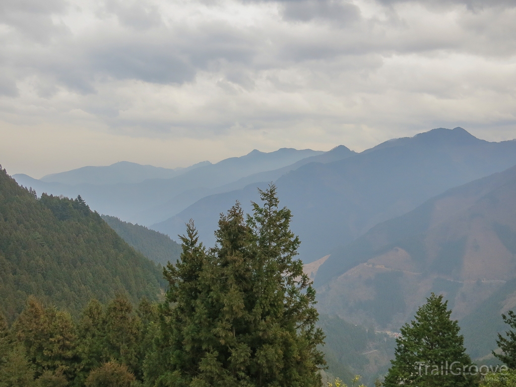
First, though, I had to find the trail, which did not start at Mt. Kumotori. It began at Mitsumine shrine, and I had a number of other peaks to traverse before I could start on Mt. Kumotori itself. As my print-out from the hiking website eloquently explained, “you’ll be on the ridge all day.” Of course, I didn’t really know what exactly that would entail. I imagined I’d be on a high plateau most of the time, maybe with some small hills to walk over. Sure, the distance may be great, and each peak might be hard if begun from ground level, but it shouldn’t be that bad staying on the ridge, right? After all, the difficulty was only a 2 out of 5.
The problem with that rating was that for someone on his first hike in Japan, it would prove to be a colossal understatement. I got my first sense of this almost immediately, when the trail began to slope up away from the shrine. And then it kept going up. Then it went up some more. I soon found myself winded, and could barely believe that the long series of switchbacks I was working my way over could ever be considered easy. Still, I was able to encourage myself by looking back at how far I’d come, and telling myself that once I was up on the ridge things would get easier.
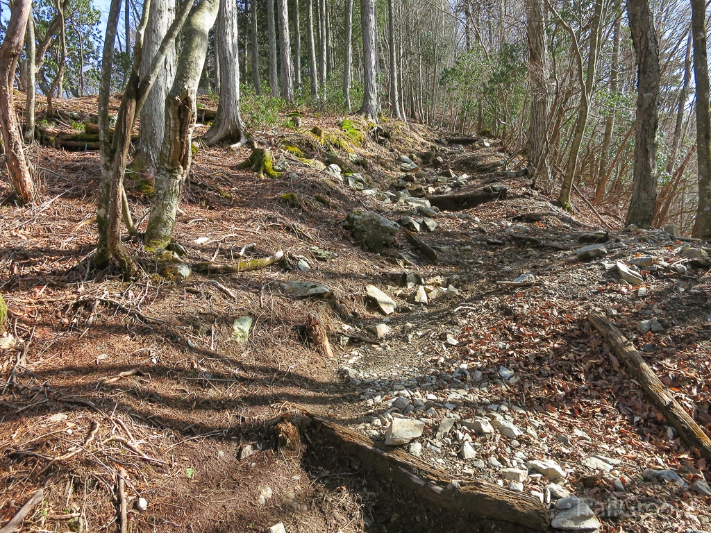
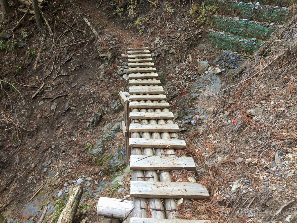
There was also the mud to contend with. Six days of rain meant that the trail was soaked, and the steep inclines were all slick and dangerous. On more than one occasion I had to use my hands to pull myself up different sections of the path, and already I was wishing for some hiking boots. When I finally reached the first peak, Mt. Kirimogamine, I felt totally spent.
My legs were stiff and sore despite the short time I’d been moving, my precious hat had seemingly welded itself to my head thanks to prodigious amounts of sweat, and I was gasping for each breath. Haunted by the need to keep up a good pace, though, I only allowed myself a five-minute break, so while I was feeling better when I set out again, by no means was I in good shape. Still, I wasn’t worried. After all, now I was unquestionably on the ridgeline, and that was supposed to mean easy climbing.
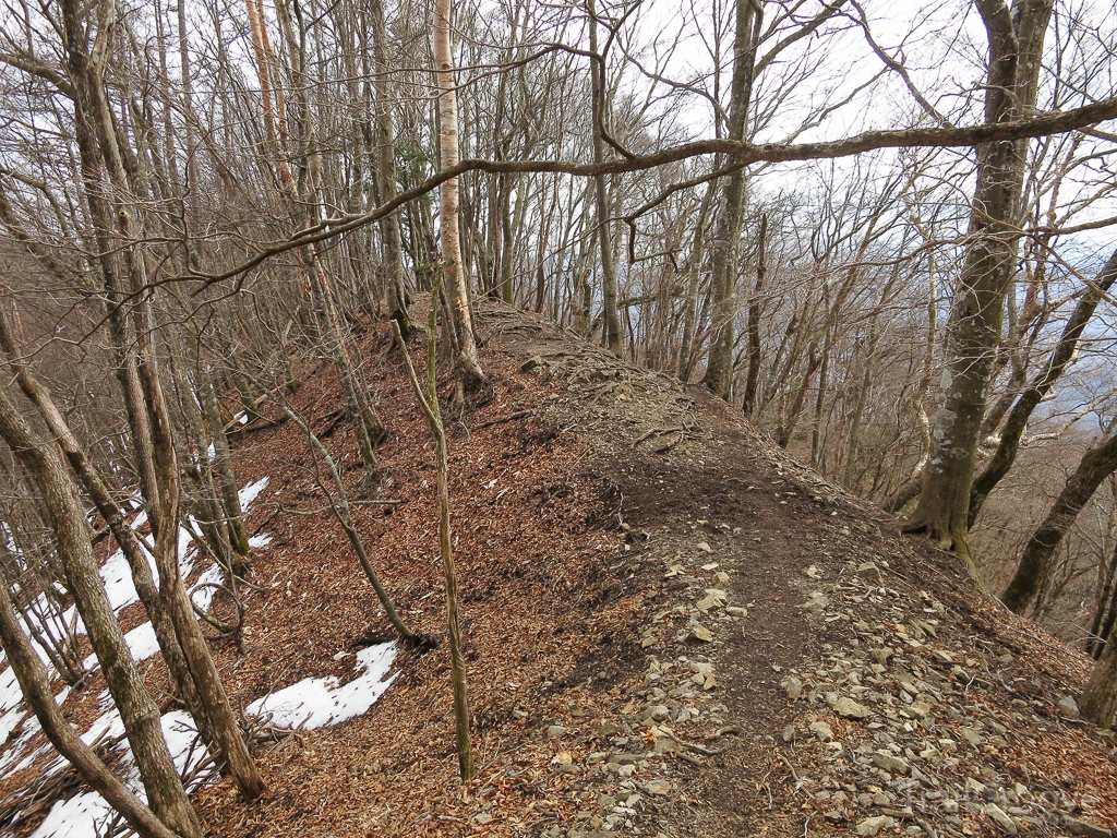
My optimism, however, would prove to be short-lived. After what felt like a much too brief descent, the path again angled upwards. This second climb was steeper than the first, though thankfully not as muddy. It was also during this ascent that I finally realized walking along the ridgeline would not be an easy task. It was instead a constant struggle of up and down. My being on it for the entire first day meant I was doomed to go through these cycles of intensely tiring climbs over and over again before even getting to the one mountain I had set out to climb. Was this really just a 2 out of 5? A 2 out of 5?!
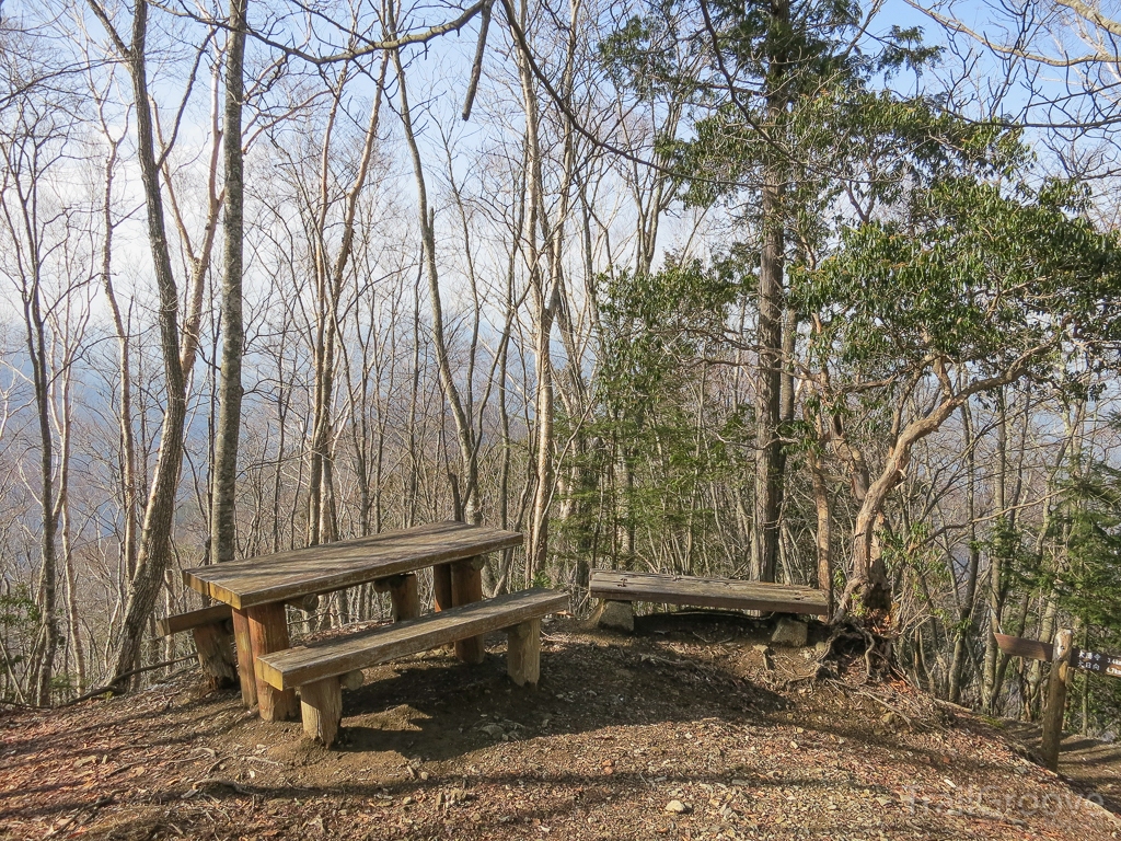
That difficulty rating became my curse as I went along, and my anger helped give me the energy to keep climbing. I went up and over the rocky slope, and then up and over a few more before finally reaching another landmark listed in my directions. It was the Mt. Shiraiwa hut, which the website placed approximately 90 minutes from where I intended to spend the night. Sitting inside was an old man who looked for all the world like he lived out here, and he was happy to brew me a cup of coffee and chat while I recovered from my exertions.
He remarked that I didn’t look ready for the rain, and, right on cue, I could hear the sound of the first sporadic drops beginning to fall outside. I briefly considered just staying here for the night, but ultimately chose to press on given how close I was to my destination. Even if the website’s difficulty scale was a far cry from my own, at least its time estimates could be trusted.
Thankfully, the rain proved to be intermittent and the path itself grew considerably easier. I felt like I’d hit my stride, and for a long time I traveled over mostly level ground. At some point this began to worry me, because I knew by now it would mean a bigger climb later. As it turned out, though, things wouldn’t actually get challenging again for quite some time.
The difficulty, when it did arrive, was also of my own choosing. As I began to finally make some progress on Mt. Kumotori itself, I came to a fork in the path. Each branch was marked with a sign and both led to my destination. The problem was the name of each path. One was relatively straight and steep, and it was marked “Man’s Path,” while the other was more roundabout, with a more gentle climb. It was of course marked “Woman’s Path.” Faced with the decision of which way to go, I let my pride get the better of me. I started up the “Man’s Path.”
I should have known better. All day I had been bemoaning how difficult this hike was, wishing for an easier way. I had been tired since first climbing up from Mitsumine shrine hours ago. And just because one path had been arbitrarily associated with men and another with women, I was hardly obligated to take the one that matched my sex. Even knowing that, though, I could not ignore the challenge of the “Man’s Path.” I railed against my decision to make things harder on myself every step of the way, but I stuck with it until, panting and exhausted, I reached the rest hut.
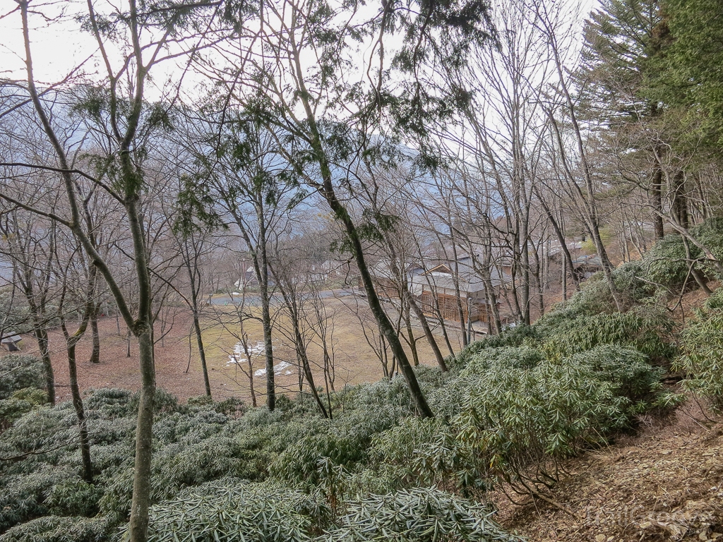
I had never spent the night out in a hut before, leaving me no idea what to expect. The hiking website had described it as “luxurious,” though what that boiled down to was paying $50 for the privilege of sleeping in a futon on the floor next to ten other people. At least there was a roof over our heads, a good source of water, and the possibility of rest. I munched on my energy bars for dinner and went to bed early in the hopes that I could rise with the sun the next morning.
Only, there was no sun the next morning, just shrouds of mist and clouds. Nevertheless, I set out early, and found the hut had been well placed just before the climb grew truly difficult. It was no easy task to wake up first thing in the morning and start climbing a mountain, especially when I was still tired and sore from the previous day, but I wanted to get as far as possible before what now seemed like an inevitable rainfall.
It helped that I had some company on this initial ascent. An older Japanese couple had left the rest hut at about the same time as me, and we started climbing together. They asked where I had started from and seemed impressed when I told them Mitsumine shrine. I found that encouraging, and they then went on to point out how foreigners were now climbing mountains all over Japan. They wished more Japanese people would get out on the trails, but explained that nobody who isn’t retired has the time.
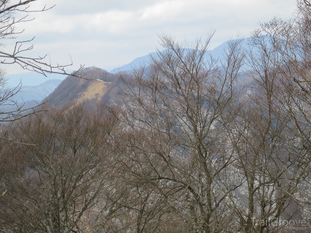
After climbing together for a while, though, I ended up needing less breaks than them, and they encouraged me to go on. The last thing they told me was that there should be a great view out to the Japanese Alps from the summit, though the weather today might block the view. So, after one last push, I reached the top of Mt. Kumotori, and sure enough, the cloud cover was so thick that nothing was visible. This had been my experience pretty much all along, with clouds obscuring any but the most immediate beauty, and I was thoroughly sick of the uniform grayness.
It felt strange to reach the top of the mountain that had been my big goal so early on the second day. Together with the useless view it felt doubly anticlimactic, but I still took a minute to let myself feel accomplished. I had successfully completed my first hike in Japan, and now all I had to do was get down. Or at least, that’s how I looked at it, but getting down soon proved to be just as much trouble as going up. To begin with, I wasn’t sure which way to go.
My directions claimed I would find an emergency rest hut, and that there were two ways down from there. One involved a long walk on a forest road while the other was presumably a more direct route down Mt. Nanatsuishi. I tried to take the longer and hopefully easier route, but in truth I’m still not sure which path I ended up on. I did find the emergency hut, but either through a trick of the fog or a misunderstanding I only saw one way to go. Whichever way it was, I soon learned that my efforts were far from over.
The rain began falling in earnest while I was still on an easy downhill section. At first I hoped for a repeat of yesterday: a few intermittent showers with no real harm done. I could not have been more wrong. The rain was constant. The rain was hard. And the rain was miserable. I made my way along the trail, becoming first damp, then wet, then soaked. The path turned into mud beneath my feet, and then began to grow unstable.
It felt discomforting to work my way along a ridge and feel it slipping away beneath my weight. It was also disturbing to discover that I wasn’t done with the ridgeline just yet. I had several more peaks left to traverse, and though this was an easier task than on the previous day, the rain had a way of making everything harder. Perhaps my worst moment came as the trail turned into a single narrow ledge. I wasn't even sure what was holding it up, because it seemed to jut out from the edge of the slope as though pinched from the side of the mountain.
The rain had weakened this precarious passage so much that it was beginning to collapse. I started to run as I made my way along it, and when I felt it giving way beneath my feet, I finally jumped over to another section of the trail. When I looked back, I doubted whether anyone would be able to follow in my footsteps. This brief moment of terror had me on edge, and it was with a constant sense of dread that I continued on my way.
Eventually, my direction shifted so I was mostly headed downhill. By this point, though, the path had essentially turned into a muddy chute. Since the bottom of the trail was so well trodden, over time it had formed into a half-pipe, with large embankments rising up on either side. Down in the center of this “pipe”, the trail consisted of a mix of water and mud that resembled nothing so much as a sluiceway. It was slippery and treacherous. Once or twice fell straight into the muck, but always managed to right myself and continue on.
At one point I ran into a fellow hiker heading in the other direction. I warned him that the trail up ahead was bad. Considering my state at the time, dripping wet and covered in mud, I thought my warning would be fairly convincing, but he merely thanked me and headed on just the same. All this time it was still raining, though by now it hardly mattered. I certainly couldn’t get any wetter, and even that change of clothes in my bag was probably sopping wet by now.
Finally, I reached the last muddy slope. At this point, I decided I might as well just sit down and slide myself to the bottom. Exhausted, and covered in mud, it would be another hour of squishing along on foot before I reached the train station and the official end of my hike. I was overjoyed when I arrived, and by now the sun was out and the sky a clear blue. It felt like the perfect day for a hike. Laughing to myself, I lifted a hand to my hat, which was rumpled and wet but still served to shield my face from the sun, and got on the train back to Tokyo.
Information: With an elevation of 2,017 meters (6,6017 feet), Mt. Kumotori, or Kumotoriyama (雲取山), is the tallest mountain in the Tokyo area. It stands as the boundary point between Tokyo, Saitama, and Yamanashi Prefectures on Japan’s main island of Honshu, and is a part of the Chichibu-Tama-Kai National Park. No permits are required for this hike, though it is generally recommended that you be bear aware, since black bears do inhabit the park.
Additional resources (in Japanese):
1. Kumotori Mountain Hut (雲取山荘) website (includes a lot of helpful information if you can read Japanese, including bus times and weather conditions as well as access to reservations.)
2. Seibu Railway timetable from Ikebukuro towards Seibu-Chichibu (Click the top link for weekdays and the bottom link for weekends/holidays. I recommend one of the express trains listed in red, since even one of those will take about an hour and twenty minutes to arrive.)
3. Seibu bus website with timetables (click on the M at the bottom right of the page to access timetables in Japanese to and from Mitsumine shrine. The two timetables on the top are going to the shrine. The two timetables on the bottom are going back to the station. In both cases, the times in red are the ones to pay attention to, so currently the first bus to the shrine leaves at 9:10 and arrives at 10:25. The next bus to the shrine leaves at 10:10, then 12:15, etc.)
4. Mitsumine Shrine official website with bus information (click the image for another timetable. Though currently the return bus times listed are inaccurate on the form, changes are listed on the website itself.)
5. Official JR page for Okutama station (click the button marked 平日 on the left for a weekday timetable or 土曜•休日 on the right for a weekend/holiday one. All trains go towards Tokyo Station, and some go direct, but most will stop at Ome Station, where you can transfer to a train going towards Tachikawa Station. Also, some trains leaving Okutama will go directly to Tachikawa Station. Either way, from Tachikawa station, you can transfer to the Chuo line and easily get around the city.)
Best Time to Go: While the Kumotori Mountain Hut is open year-round, and the consensus on a good hiking time seems to run from mid-April to late-December, my recommendation would be to go in the early fall, September, or October. Note that early-May and mid-August are peak travel times for Japanese hikers due to holidays, and the huts are likely to be very crowded during those time frames.
Getting There: From Ikebukuro station (池袋駅) in Tokyo, ride the Seibu Railway line (西武鉄道) to Seibu-Chichibu station (西武秩父駅). From there, take a bus to Mitsumine Shrine (三峰神社). The trail starts from the parking lot, branching off to the right as you climb the stairs. To get back to Tokyo after the hike, simply take a train from Okutama station directly back into the city.
Maps: Chichibu-Tama-Kai National Park.
Books: Climbing a few of Japan's 100 Famous Mountains - Volume 5: Mt. Kumotori, by Daniel H. Wieczorek and Kazuya Numazawa.
-
 3
3

6 Comments
Recommended Comments
Create an account or sign in to comment
You need to be a member in order to leave a comment
Create an account
Sign up for a new account in our community. It's easy!
Register a new accountSign in
Already have an account? Sign in here.
Sign In Now