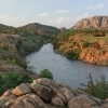
A cool, rainy weekend in early April provides the perfect backdrop for a hike on Arkansas’ Buffalo River Trail. Moist spring weather in the Ozarks means the lush hardwood and pine forest is bursting with wildflowers, ferns and all manner of growth, keeping hikers engaged in identifying each plant and marveling over the delicate and diverse shapes and intense colors. Cloudy, humid weather intensifies the deep, vernal greens enveloping the trail, and likewise accentuates the rainbow shades of coun
Washington's Cascades have an unfriendly reputation. Unlike the Rockies and Sierra, whose alpine basins and gentle saddles allow for easy travel, the Cascades are a maze of serrated ridges and deep, heavily-forested valleys containing swift-flowing rivers. While miners built high roads in Colorado in the 1800s that now service trailheads, most Cascades trailheads are in valley bottoms barely above sea level, deep in the dense coastal forest. The crux of a climb is often escaping 4,000 feet of ve
Although I did several trips on cross-country skis and snowshoes that involved camping out in the Northern Rockies in below freezing temperatures for multiple nights, the past few years my definition of “winter backpacking” has either included a US Forest Service rental cabin with a wood stove or a plane ticket to southern Arizona. I still find winter to be a beautiful time of year and I enjoy the heightened elements of the season that seem so magical, but I just hadn’t hadn’t been motivated to
Sitting atop the summit of Mount Saint Helens, with views of over a hundred miles in every direction, a passage from a novel came to mind as I sipped a cup of coffee and gazed at distant peaks. Seemingly appropriate when applied to an exceptionally clear autumn day observed from atop a mountain, an experience that makes one feel full of life. It felt like the “most beautiful day in a thousand years. The October air was sweet and every faint breath a pleasure.” As Annie Proulx wrote in the book,
Canada's Rocky Mountain Parks are a great location for hiking, and attract millions of visitors every year. At 10,878 km² (4,200 sq. mi.) Jasper is one of the largest, but Banff, Yoho and Kootenay National Parks are also part of the network as is Mt. Robson Provincial Park in British Columbia and Waterton in Southern Alberta. Much of the traffic tends to go to the commercial hub of Banff, leaving the rest for hikers and others who enjoy the wilderness.
But my philosophy has always bee
I stood, breathless and exhausted, on the top of the divide, looking down at the pristine and untrailed cirque that lay ahead. My route bared before me, for a moment continuing on across the three passes that lay ahead seemed achievable. Then my eyes lifted to the glaciated massif of 7,600-foot Mount Mystery on the opposite wall of the basin, and my shaking legs sent an unmistakable message: I would make it no further.
Olympic National Park offers hikers rugged terrain and stunning vi
If you're in the Midwest, the Porcupine Mountains might be your #1 go to backpacking destination. Scenic views abound and old growth forests dominate the interior. Head to the north side of the park and you'll find yourself greeted with the pristine and beautiful waters of the world’s largest freshwater lake. For an excellent day hike, park at the Lake of the Clouds overlook and explore the Escarpment Trail (amazing views).
Along the Escarpment Trail in the Porcupine Mountains
If
The Owens Valley and its surrounding mountains are far from the place I grew up and have become one of my favorite parts of this great nation. When I first came here I felt like I had discovered a secret. A lost and secret land. This dry country goes unconquered by man.
The valleys between the mountain ranges are grand, quiet and peaceful, possessing a haunting beauty unique to this area. To many who first look upon it, the starkness of this landscape seems unnatural and provokes confusion,
For most hikers and backpackers, when they think of Washington their thoughts tend to drift to the rugged grandeur of the North Cascades or the rainforests, beaches, and mountains of the Olympic Peninsula. The beauty and opportunities for amazing trips in those locales can certainly not be understated. As evidenced by increasing crowds at many trailheads in recent years, and stiff competition for permits in areas where they are required, the public lands in the western part of the state aren’t (
Reasoning that I’m not getting any younger, I decided recently that the Grand Canyon was something I needed to do before I no longer could. Such a decision, by its very nature, triggers some urgency. And “doing the Grand Canyon” meant, for me, a rim-to-rim hike.
But as I began to navigate Grand Canyon National Park’s backcountry permit system, I realized that actually hiking the hike might not be the hardest part. Obtaining the necessary permit for camping within the canyon on a multi-night
The opposite bank is tantalizingly close, just a couple of meters away. In fact, it would be fewer than 10 paces on solid ground. Instead, we can only gaze longingly across the un-crossable, raging river that stands between us and the next section of our route. We are stuck on the west bank of the Duke River. It’s a crushing defeat. On a normal hike, this would be a mild inconvenience, but we are on day six of a backpacking epic that is far from normal.
View of a scenic upland section
A cheerful pumpkin sun peeks over the Coconino Plateau at dawn. It’s Thanksgiving weekend, and the air is frosty as dad and I join a gaggle of backpackers, clad in billowy down jackets evincing a cornucopia of startling colors, lining up outside Grand Canyon Village’s backcountry information center. It turns out the park’s Phantom Ranch and Indian Garden campgrounds are as jam-packed as pilgrims on the Mayflower which renders my hoped-for rim to rim route unfeasible. A bearded ranger suggests we
Most backpacking trips enter a figurative “Paradise” at some point or another. It could be an exquisite sunset, a perfect campsite, or time spent mesmerized by a waterfall. My trip along the Selway River Trail with my stalwart backpacking companion Justin had the amusing distinction of actually beginning at a Paradise. The Paradise boat launch and trailhead in the Bitterroot National Forest in a remote corner of Idaho, to be exact.
From here we would follow the Selway River downstream
It’s almost as if the Pacific Ocean is a magnet, pulling me west each time I venture out to explore. While I take full advantage of the natural wonders offered by my home region in the central U.S., if I am traveling very far to hike, it is usually somewhere west of Oklahoma. As a result, I have hiked very little in the eastern United States, though I’ve managed to walk short sections of the Appalachian Trail on trips to Vermont and Maryland. Not much to brag about.
Recently, I was in
Arkansas: The Natural State. Nothing is more natural than this remote wilderness deep in the Ozark National Forest in the northern part of the state. This wonderful wild place is known as Richland Creek Wilderness, where waterfalls, not-so-secret caves, thick forests, swimming holes, bluffs, colorful fall foliage, wildflowers, and more are to be found. There are a multitude of boulder-dotted creeks in the Wilderness, the main ones being Big Devils Fork, Long Devils Fork, and Richland Creek. Rich
I love the wide open spaces and views of the American West. So, I arranged for another westward trek, this time to southern Nevada. My sister Melissa and I drove her Toyota 4Runner, an excellent vehicle for the narrow, rough roads on which we would be driving. We planned on going to the Buffington Pockets area, Gold Butte National Monument, both northeast of Las Vegas, and the Vermilion Cliffs in northern Arizona (the subject for another story).
We added, on the fly, a visit to Grand
Water and sand, water and sand, water and sand – it’s been a few years since I visited the canyon country of Utah and I forgot about the mix of water and sand here that can permeate one’s hiking shoes. I should have worn sandals. I read about walking the wet canyon bottom, but I stuck with my hiking shoes anyway. This time I arrived to explore Coyote Gulch, a photogenic but crowded canyon which cuts across Grand Staircase National Monument and the Glen Canyon National Recreation Area of south-ce
For at least half an hour, the solar eclipse seemed like a total bust. Sure, I could glimpse a chipped-out corner of the Sun with my rinky-dink eclipse glasses, but its apparently-undaunted intensity continued to bounce off the surface of Fiddler Creek, searing my skin and melting the chocolate in my food bag. But as totality approached, the atmosphere finally changed. An eerie glow settled over the landscape, and birds began to chirp their evening songs.
The Sun, even 99% covered, ha
Words fail and even photographs fall short of doing justice to the incredible Narrows hike in Zion National Park, especially in the fall. The Southwest US is a treasure trove of world-class locations to hike and photograph, but the Narrows has to be at or near the top of that list. It’s hard to imagine a blue-green river lined with golden cottonwood trees and soaring canyon walls glowing fiery red all around you. Surreal and otherworldly are about the only words that come close to describing the
I turned up the heat in the car at the trailhead. It was a chilly, near freezing November morning as we finished getting our gear ready. There was a sense of excitement. As I hoisted my pack, I could feel the not-so-gentle protrusion of the solid kitchen frying pan in my back. I knew it would be worth it. I carefully left my key in the car in the prearranged location, hoping that the arranged transportation would deliver it to the end of the trail as planned.
There were three of us: a good
November tends to be a dead zone for Colorado hikers. It's too early for skiing or even snowshoeing in the high country. But cold temps and the threat of blizzards are present even if the snow is lacking. Most backpackers sit out the month, maybe catching up on their favorite trail magazine. Not all Colorado is high country and 14er's though. Out beyond the West Elks, the Uncompahgre Plateau runs from the Utah border 60 miles southeast down to the edge of the San Juans. Elevations range from 400
I hear the wind approaching as it moves up the ridge. No other sound breaks the night's long silence, not even the rustle of a possum in the undergrowth. It is early autumn in a year of drought; perhaps the lack of water at this elevation keeps the critters away, which suits me fine. We took care to hang the bear bag high off the ground, regardless. Why tempt fate?
I drift off, awakening later to an unmistakable sound a few feet away. Zzip! Opens the tent. Zzip! Closes the tent. It is Mary,
If you’re traveling on California Highway 395 along the striking escarpment on the eastern side of the Sierra Nevada south of Yosemite and looking for a high-elevation hike deep in the heart of the mountains, but you only have a day or less, various roads off the main highway take you up to trailheads between 8,000 and 10,000 feet quite easily and quickly where you’re immediately immersed in stunning alpine scenery.
For example, out of the town of Bishop, you can take Highway 168 stra
I’m no stranger to a new challenge. Two years ago, after two decades as a carpenter and building contractor, I took a chance and changed my life. Though sawdust runs in my veins and I’ve always imagined myself as a builder to the end, the only other profession I thought I might like is teaching. In October 2019 that notion became reality when I became an instructor in the Building Construction Technology Program at a local Community College. That’s when the challenge began.
The idea of teac
You’ve no doubt heard of the John Muir Trail, justly known as one of America’s premier hiking trails. Perhaps you have even hiked it (if not, put it at the top of your hiking bucket list). But the JMT is not the only long trail through the heart of the Sierra Nevada. Just 10 miles to its west, the Theodore Solomons Trail parallels the JMT. Starting at Horseshoe Meadows south of Mt. Whitney, it bears west over the Kern drainage, turns north to Mineral King, then keeps to the west sides of Sequoia